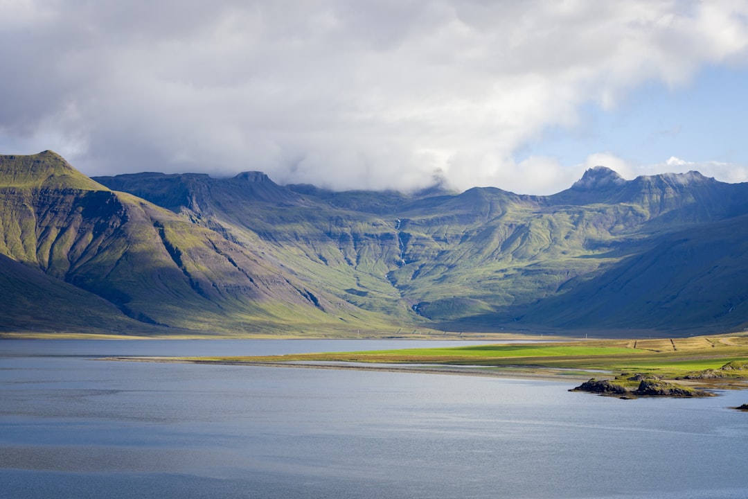
Planning a road trip in West Iceland is all about freedom—endless horizons, dramatic coastlines, and quiet valleys where you might not see another car for miles. But that freedom comes with one golden rule: always check the road conditions before you drive.
Iceland’s weather can change quickly, and a road that looks fine in the morning can be icy, windy, or even closed by afternoon. Learning how to use Iceland’s road condition maps will make your journey safer, smoother, and far more enjoyable.
Below is a simple guide to using these maps, with tips tailored to travelers staying at Ourhotels.is properties: Hvítá Inn in Borgarfjörður, Stykkishólmur Inn on the Snæfellsnes Peninsula, and Ísafjörður Inn in the Westfjords.
—
### 1. Where to Find Iceland’s Road Condition Maps
The official and most reliable source is:
– **Road.is** – The Icelandic Road and Coastal Administration website
This site shows real-time information on:
– Road surface (clear, wet, icy, snow-covered)
– Road closures
– Wind warnings
– Webcams along major routes
There’s also a mobile-friendly version and an app, which is very useful when you’re on the move.
When staying at any Ourhotels.is property, you can use the hotel Wi-Fi to check Road.is each morning and again before any longer drive.
—
### 2. Understanding the Map Colors and Symbols
On Road.is, you’ll see a color-coded map:
– **Green** – Roads are clear and easily passable.
– **Blue / Light Blue** – Wet or slushy; drive with care, especially in colder temperatures.
– **Orange / Red** – Snow, ice, or difficult conditions; only drive if you’re experienced and properly equipped.
– **Black / Red Line** – Road closed; do not attempt to drive there.
– **Wind Icons / Warning Symbols** – Strong winds, blowing snow, or other hazards.
Clicking on a road segment gives more detail, such as:
– Surface condition
– Temperature
– Last update time
This is especially important in winter and shoulder seasons when conditions can change quickly in West Iceland and the Westfjords.
—
### 3. Using Road Maps When Staying at Hvítá Inn (Borgarfjörður)
Hvítá Inn, near Borgarnes, is a perfect base for exploring Borgarfjörður, Hraunfossar and Barnafoss waterfalls, Deildartunguhver hot spring, and the surrounding countryside.
Before you head out:
1. **Open Road.is** and zoom into West Iceland and Borgarfjörður.
2. **Check Route 1 (the Ring Road)** between Reykjavík, Borgarnes, and northwards. This is your main lifeline.
3. Look at **local roads** leading to:
– Hraunfossar and Barnafoss
– Reykholt
– Deildartunguhver
If you see:
– **Green or light blue** – You’re generally fine to drive, but still adjust speed to conditions.
– **Orange or red** – Consider delaying your trip or choosing a shorter, safer route.
– **Closed roads** – Ask the staff at Hvítá Inn for alternative plans; they know the area well and can suggest safe activities nearby.
Because Hvítá Inn is in a rural area, conditions can be more wintry than in Reykjavík, even on the same day. Always trust the map and local advice over how the weather looks out the window.
—
### 4. Using Road Maps from Stykkishólmur Inn (Snæfellsnes Peninsula)
Stykkishólmur Inn is an ideal base for exploring the Snæfellsnes Peninsula—often called “Iceland in Miniature” for its mix of mountains, lava fields, beaches, and small fishing villages.
From Stykkishólmur Inn:
1. On Road.is, zoom into **Snæfellsnes**.
2. Check:
– **Route 54** (the main road around the peninsula)
– **Route 56** (Vatnaleið) if you’re crossing the peninsula
– Any smaller roads leading to viewpoints or beaches
Pay special attention to:
– **Wind warnings** – Snæfellsnes can be very windy, especially near the coast.
– **Icy or snow-covered roads** – Common in winter and early spring.
If the map shows:
– **Strong wind icons** along Route 54 or 56 – Consider postponing or shortening your drive. High winds can be dangerous, especially in high-profile vehicles.
– **Snow or ice** – Drive slowly, use lower gears on hills, and keep extra distance from other cars.
If conditions look challenging, the team at Stykkishólmur Inn can help you adjust your plans—perhaps focusing on nearby attractions in and around Stykkishólmur itself until the roads improve.
—
### 5. Using Road Maps from Ísafjörður Inn (Westfjords)
The Westfjords are one of Iceland’s most dramatic and remote regions, and Ísafjörður Inn puts you right in the heart of it. But this beauty comes with more demanding driving, especially outside of summer.
From Ísafjörður Inn:
1. Open Road.is and zoom into the **Westfjords**.
2. Check:
– **Route 60 and 61** – Main access roads to and from Ísafjörður.
– **Mountain passes** – These are often the first to close or become difficult.
– Any roads leading to smaller fjords or viewpoints.
In the Westfjords, you must take:
– **Road closures** very seriously. If a pass is closed, there is no safe way through.
– **Icy and snowy conditions** as the norm in winter, not the exception.
If you see:
– **Black or red lines (closed)** on your planned route – Do not attempt to drive. Ask the staff at Ísafjörður Inn for updated information and alternative activities.
– **Frequent wind or snow warnings** – Consider staying local, exploring Ísafjörður town, museums, cafés, and nearby short drives that remain open and safe.
The staff at Ísafjörður Inn are used to helping guests navigate Westfjords conditions and can interpret the road maps with you if you’re unsure.
—
### 6. Combining Road Maps with Weather Forecasts
Road conditions depend heavily on the weather, so it’s smart to use both:
– **Road.is** – For road surface, closures, and webcams.
– **Vedur.is** – The Icelandic Meteorological Office for weather forecasts, wind, and storm warnings.
Before leaving Hvítá Inn, Stykkishólmur Inn, or Ísafjörður Inn:
1. Check **Road.is** for your route.
2. Check **Vedur.is** for the time period you’ll be driving.
3. Adjust your departure time if heavy snow, rain, or strong winds are forecast.
—
### 7. Practical Tips for Safe Driving in West Iceland and the Westfjords
– **Plan shorter driving days** in winter. Distances that look small on the map can take much longer in snow or wind.
– **Avoid driving late at night** in poor conditions; visibility and help are both limited.
– **Use the webcams** on Road.is to see real-time views of key roads and passes.
– **Rent a suitable vehicle** for the season (often a 4×4 in winter).
– **Listen to local advice** from Ourhotels.is staff—they live with these conditions every day.
—
### 8. How Ourhotels.is Fits into a Safe and Scenic Road Trip
Staying at Ourhotels.is properties gives you a natural rhythm for your journey through West Iceland and the Westfjords:
– **Hvítá Inn (Borgarfjörður)** – A countryside base close to Borgarnes, ideal after leaving Reykjavík and before heading further north or west.
– **Stykkishólmur Inn** – Perfect for exploring the Snæfellsnes Peninsula without rushing, with time each morning to check the road maps and choose the best direction for the day.
– **Ísafjörður Inn** – A comfortable, central base in the Westfjords, where careful use of road condition maps is essential for safe exploration.
By checking Iceland’s road condition maps each day and combining them with local knowledge from Ourhotels.is staff, you can enjoy the wild landscapes of West Iceland with confidence—choosing the safest routes, the best weather windows, and the most rewarding stops along the way.